
Monroe County Officials Tour FDOT Traffic Operations Hub, Spotlight Technology Managing U.S. 1 Corridor
Visit to Miami control center underscores reliance on smart systems to manage congestion and safety in the Florida Keys.

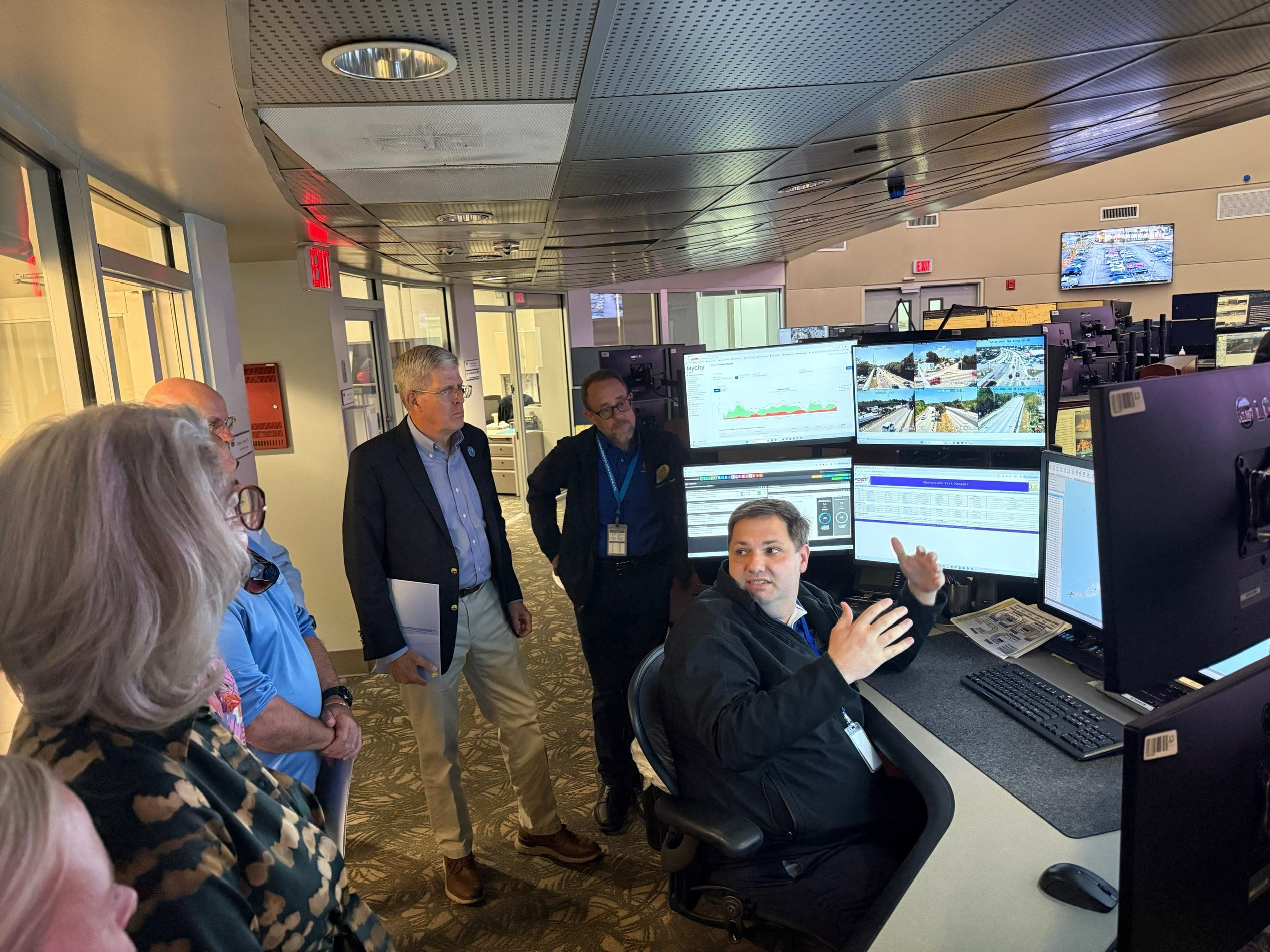
Monroe County’s top elected officials traveled north last week for a behind-the-scenes look at the nerve center that quietly orchestrates traffic flow along the only highway in and out of the Florida Keys.
Mayor Michelle Lincoln and Commissioner Jim Scholl toured the Florida Department of Transportation’s District Six Transportation Management Center in Miami, where engineers and operators monitor live camera feeds, coordinate traffic signals and respond in real time to crashes and lane closures along U.S. 1.
The delegation met with District Six Secretary Daniel Iglesias and senior FDOT staff for an overview of the agency’s Transportation Systems Management and Operations program, known as TSM&O. The approach emphasizes technology and coordination rather than costly roadway expansion — a critical distinction in the geographically constrained Keys.
“This tour really highlighted how much is happening to keep traffic moving safely and efficiently along U.S. 1,” Lincoln said in a statement. “With limited space in the Florida Keys, these types of smart, technology-driven solutions are critical for both our residents and our visitors.”
County Attorney Bob Shillinger, Growth Management Director Emily Schemper, Public Information Officer Kristen Livengood, Executive Aide Kacey Hunt and Public Works representative Leo Morin also attended.
From a wall of screens in Miami, operators monitor traffic conditions across South Florida and into Monroe County. The system integrates live video, dynamic message signs, traffic signal coordination and data-sharing with local law enforcement and emergency responders.
The growth in technology along the Keys corridor has been dramatic over the past two decades. In 2005, Monroe County had only a handful of traffic management devices. Today, the network includes 95 cameras, 37 traffic signals, dynamic messaging signs, pedestrian beacons, emergency signals and nearly 60 roadside communication units supporting corridor operations.
In 2025 alone, FDOT tracked 476 scheduled roadwork events on U.S. 1, along with 130 crashes and 23 disabled vehicles that resulted in lane blockages, underscoring the highway’s vulnerability to disruption.
Staff at the center coordinate closely with the Monroe County Sheriff’s Office, Florida Highway Patrol and emergency services to manage incidents and relay information to motorists.
The tour also highlighted several upcoming improvements in the Keys, including signal upgrades at College Road, flood mitigation and signal improvements near Eisenhower Drive, and continued work at the Key West Triangle intersection.
For Monroe County, where U.S. 1 serves as both main street and evacuation route, the emphasis on data-driven traffic management reflects a broader strategy: extract more efficiency and safety from existing pavement rather than attempt to widen a highway bordered by ocean and environmentally sensitive lands.
For more information, visit monroecounty-fl.gov/engineering.