

BREAKING: NWS Issues Gale Watch for Florida Keys
Northerly gales, heavy seas, extremely rough nearshore waters, and life-threatening water temperatures are expected.

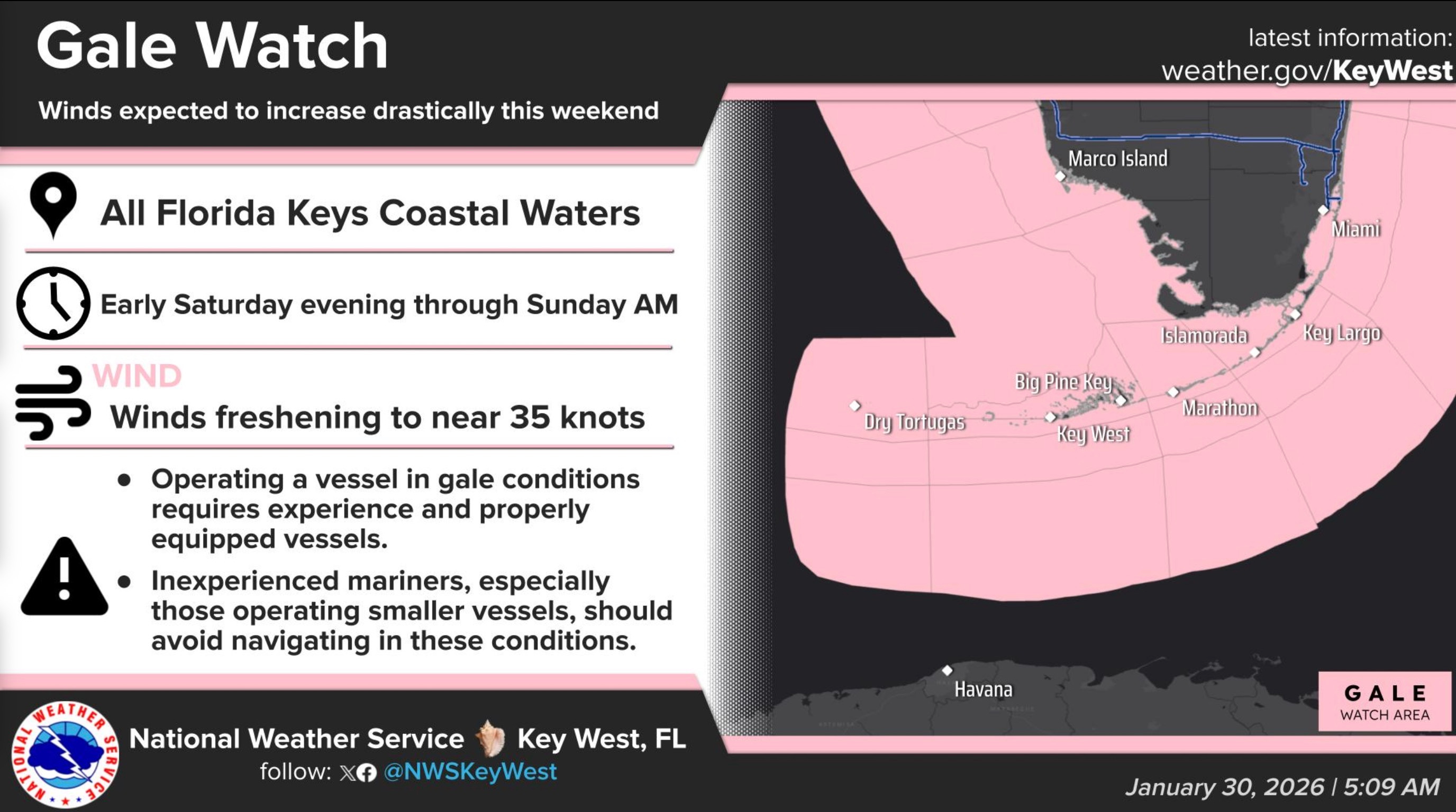
From the National Weather Service Key West:
A rapidly intensifying coastal cyclone will form east of the Carolinas over the next 18 hours. Meanwhile, an Arctic anticyclone will spill southward into the Great Plains. This setup will drive a powerful cold front through the Keys on Saturday, preceded by rounds of potent squalls, and culminating in northerly gales (sustained near 35 knots, gusting near 45 knots), heavy seas (significant wave heights will peak near 16 feet across the southeastern Gulf and the Straits of Florida, and as high as 8 feet at the Reef), extremely rough nearshore waters, and the coldest temperatures to impact the Keys since 2010. Small Craft Advisory conditions are expected Saturday morning, and winds will steadily increase through the afternoon, then peak Saturday evening through Sunday morning when a Gale Warning will be in effect. Small Craft Advisories are likely to persist through Sunday afternoon. Remember, although a 35 knot wind is only a 1.75 increase in speed over a 20 knot wind, the force of a 35 knot wind is 3x that of a 20 knot wind. Gale-force winds are strong enough to impede walking.
Gale Watch is in effect for all coastal waters of the Florida Keys--a Gale Warning will be required Saturday evening through Sunday morning
Northerly gales, heavy seas, extremely rough nearshore waters, and life-threatening water temperatures are expected.
If you live or work in a mooring field or anchorage (e.g., Key West Bight or Boot Key Harbor), please remember that winds of these magnitudes will flip dinghies. Plan your transits to and from the mooring fields and anchorages accordingly, or find a safe haven ashore. Always wear a life jacket—it is the most proven way to save a life.
The wind is not the only story. The wind chills will fall into the upper 20s to lower 30s in the Upper Keys, and the mid to upper 30s in the Middle and Lower Keys. A Cold Weather Advisory will be required for portions of the Middle and Upper Keys. Frostbite and hypothermia will be possible with prolonged exposure. The shallow waters Bayside of the Middle and Upper Keys will quickly respond to the Arctic air mass, with sea surface temperatures falling into the lower to mid 50s. Cold water (defined as 59F or below) triggers cold shock—an involuntary gasp reflex—which can lead to immediate inhalation of water and drowning. Do not risk being on the water this weekend if you can avoid it.
For more information, please consult the following sources.
Florida Keys Marine Weather Page:
https://www.weather.gov/key/marine
NOAA/NWS Florida Keys Home Page:
Monroe County Emergency Management
https://www.monroecountyem.com/1324/Emergency-Management/
Social Media:
Facebook (https://www.facebook.com/NWSKeyWest)